 Scale: 1:2,500,000
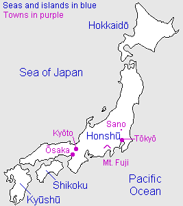
In addition to the main islands - Honshu, Hokkaido, Kyushu, and Shikoku - includes a location map showing Russia and Korea, and the southern islands down to Okinawa and Taiwan.
Kanji key
 | Nihonkai (Sea of Japan) |
 | Taiheiyo (Pacific Ocean) |
 | Hokkaido - second largest island |
 | Honshu - the largest island |
 | Shikoku - fourth largest island |
 | Kyushu - third largest island |
 | Okinawa |
Useful generic kanji
 | ken ("prefecture") |  | yama or -san (mountain or Mt.-) |
 | shi ("city") |  | kawa or gawa (river) |
 | machi or cho ("town") |  | shima or tou (island) |
 | mura or son ("village") |  | mizu-umi or -ko (lake) |
General map symbols
 | International boundaries |
 | Prefectural (ken) boundaries |
 | Minor boundaries (Hokkaido) |
 | Ferry routes |
 | Expressways |
 | Principal roads |
 | Other roads |
 | Shinkansen ("bullet train") |
 | Other railways |
| Prefecture names in large purple characters |
| Prefectural capital |
| Cities |
| Towns, etc. |
| Mountain summit |
| Airport |
| Lighthouse |
| Famous sites |
| Onsen (hot springs) |
